


by Will Tilsley, on 06-Oct-2021 10:48:52
In a recent blog on satellite services, Steve Critchlow stated the case for how satellite imagery has now come of age due to the technological advancements enabling it to finally realise its true potential.
The core of that piece was really to do with the cloud and AI (essentially democratising this incredible technology in terms of access and pricing).
But that is only one aspect of the maturity journey of satellite imagery and services.
Three key components of this next-generation technology are now driving new use cases for industries and organisations everywhere:
- Resolution
- Daily change detection and monitoring
- Multispectral (and hyperspectral) capabilities.
Resolution
First of all, satellite imagery services most likely failed to take off until now because of a resolution deficiency. Today this is categorically not the case, with Critchlow Geospatial partners like Maxar providing native 30 cm resolution and derived (using a proprietary processing algorithm) 15 cm high-definition imagery.
Now that machine learning and artificial intelligence can also be applied to the imagery for feature extraction for things like vehicle detection, vegetation type, or roof types, the resolution issue is simply no longer valid.
Daily change detection and monitoring
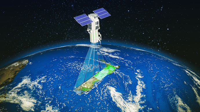
When you combine this level of resolution (and processing) with the capability for new imagery to be captured DAILY then you have an incredibly powerful tool for understanding and anticipating the changes (both human-created and natural) in New Zealand’s continuously evolving environment.
This kind of easy access and on-demand intelligence is ideal for assessing risk, monitoring land use, and planning infrastructure and development. Indeed, Persistent Change Monitoring (PCM) available with Maxar’s SecureWatch can even automate change detection for you, by highlighting human construction over time as this local example shows.
For uniquely New Zealand specific applications, Critchlow Geospatial can assist with creating localised detection models to apply to this daily imagery for our clients’ particular areas of interest.
In addition (through our suppliers), Crichlow Geospatial can provide ready access to vast satellite imagery archives that can provide a unique historical context of change with what is essentially a “digital time machine”.
Multispectral/hyperspectral imagery
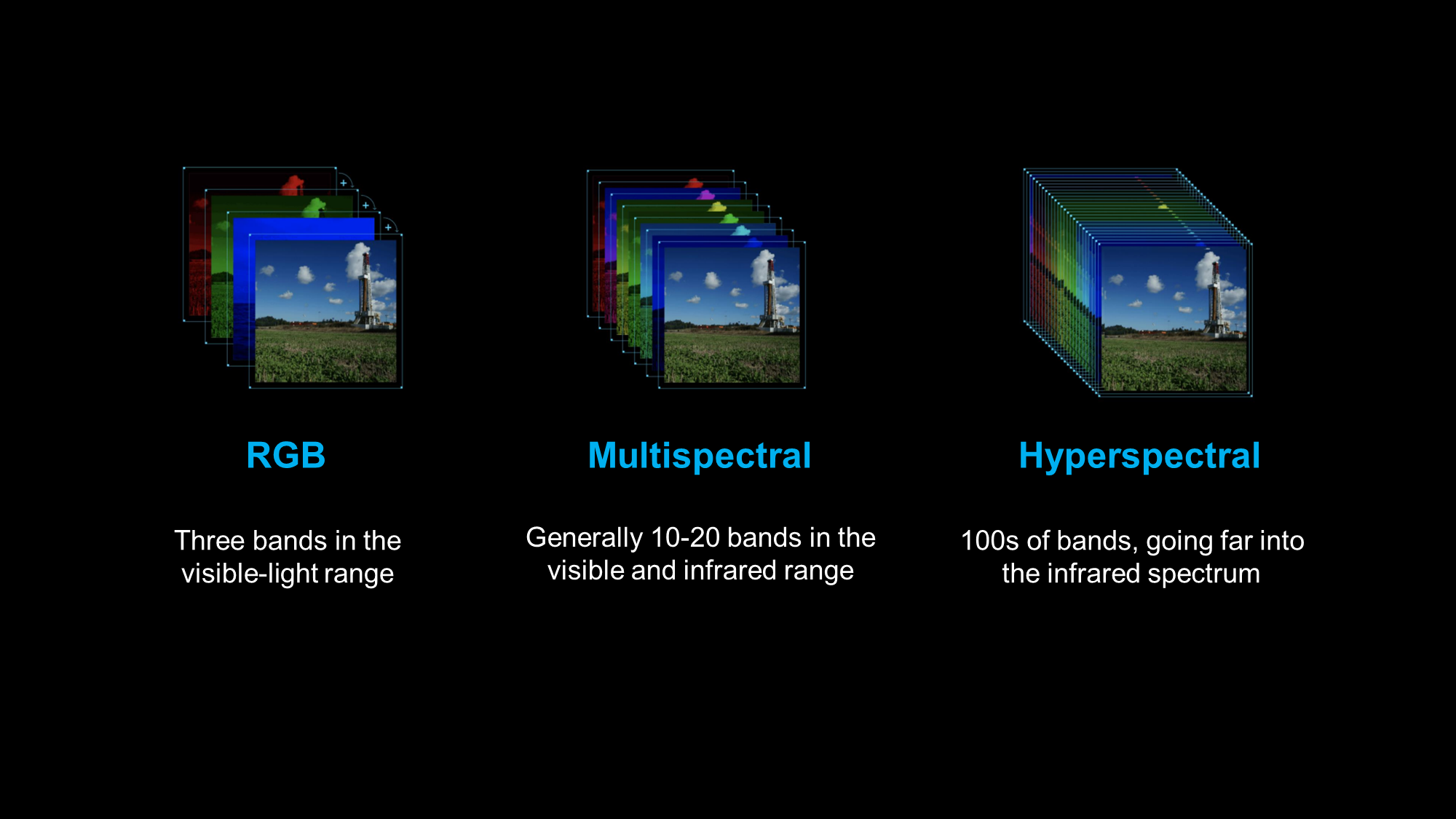
Different materials reflect and absorb light differently and at different wavelengths, which is essentially how we see colour – multispectral imagery just takes this to the next level.
Multispectral imaging works by capturing image data within specific wavelength ranges from across the electromagnetic spectrum. This can include frequencies such as infrared and ultra-violet - these are wavelengths beyond the visible light range for humans and so allows for the extraction of information that the human eye would be unable to capture.
With multispectral imagery, it is possible to differentiate materials by what is known as their “spectral reflectance signatures”. These unique 'fingerprints' enable identification of materials, for example, the spectral signature for oil can help detect and ascertain the area of oil spills at sea.
Hyperspectral imagery is next level again and enables segmentation and classification of land and aquatic features to a very granular level (but of course like anything to do with satellite imagery – also at scale).
For example, hyperspectral imagery can actually identify and quantify molecular absorption, inferring biological and chemical processes, and has been used in this capacity to monitor the application of pesticides for quality control and optimum dose coverage.
So essentially, while multispectral imagery can be used to identify land surface features, materials, and landscape patterns, hyperspectral imagery can allow for the identification and characterisation of (among other uses):
- Vegetation health
- Man-made or natural materials
- Mineral deposits
- Soil moisture levels.
For the primary industries, multispectral and hyperspectral imagery will prove invaluable in the “at scale visualisation” of plant development, land use, and land cover characterisation. Clearly, the applications for environmental protection and emergency response are also huge, particularly when you consider the ability of this type of imagery to penetrate both smoke and cloud cover.
The power of this next-generation satellite services technology is really quite staggering. And, because the Cloud and AI have democratised access and affordability, it means that there is (finally!) no reason why New Zealand businesses and organisations can’t harness it to make a great leap forward in both innovation and productivity.
If you’re ready to chat about our satellite services today, get in touch – we’re here to help.

.png "GL_A GenLess Organisation_WHITE (2)")