


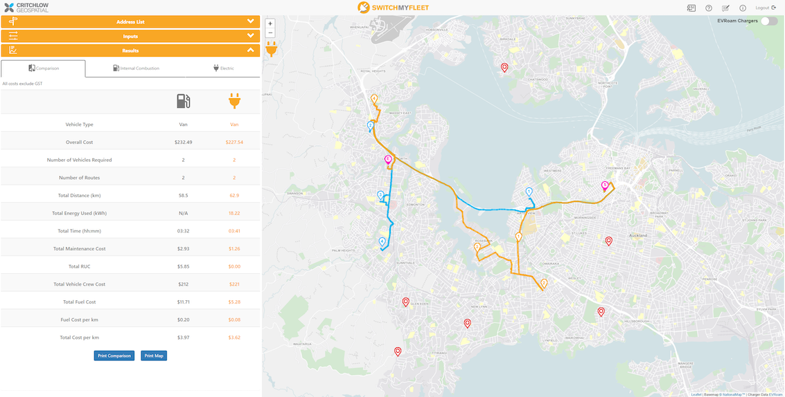
SwitchMyFleet, powered by NationalMap, is a website that provides operational cost comparisons between internal combustion engine vehicles (ICE) and electric vehicles (EV).
Gain the confidence of having trusted, authoritative mapping data as the basis of your business decisions. NationalMap’s offerings are designed to be flexible and customisable to meet your requirements, and easy to use with your existing GIS or CAD tools.
For organisations focused on reducing their carbon footprint, utilising satellite imagery, alongside aerial imagery, can expedite emission reductions and goal attainment. In New Zealand, commercial satellite imagery offers valuable insights for environmental risk management, owing to its rapid capture, dissemination, and advanced analysis capabilities..
Alongside CNAR, Critchlow Geospatial’s comprehensive New Zealand dataset, IQ Office offers a complete, highly integrated solution to address and resolve information quality issues.
-1%20v2.png)
Use MapInfo Pro to see patterns and identify trends more easily with detailed maps and graphics, enabling your people to make more informed decisions and capitalise on untapped business opportunities.
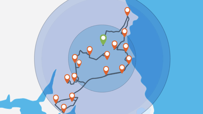
Smart routing for small business helps you manage demand, reduce costs and improve productivity. With no setup required start growing your business today!

+64 4 472 8244 (New Zealand)
.png "GL_A GenLess Organisation_WHITE (2)")