


by Steve Critchlow, Group Managing Director, on 25-Aug-2021 09:24:01
On-demand, high resolution SAR data and analytics now available to New Zealand government and private sector
Critchlow Geospatial is pleased that Capella has chosen us to represent them in New Zealand. Capella’s mission is to “make timely Earth observation an essential tool for commerce, conservation, and well-being. A world that shares a richer understanding of life on our planet will be a better place to live; we contribute to that knowledge by documenting change across the globe in entirely new and powerful ways.”
Capella is different
Synthetic Aperture Radar (SAR) offers a different perspective as it transcends the elements of weather and the darkness of night. Despite the cool factor that it offers self-service tasking and image download via the Capella web platform, Capella’s SAR data is surprisingly affordable and easy to use.
The benefits of Synthetic Aperture Radar (SAR)
-1.png?width=4383&name=WhakaariWhiteIsland%20(1)-1.png) Image: Whakaari/White Island, New Zealand, 24 June 2021, 10:00 pm NZT
Image: Whakaari/White Island, New Zealand, 24 June 2021, 10:00 pm NZT
Capella’s growing constellation of synthetic aperture radar (SAR) satellites provides 24-hour all-weather Earth observation. What makes SAR unique is its ability to penetrate atmospheric conditions, providing near real-time visibility in cloud covered areas, both day and night.
Capella Space’s commercial SAR technology offers many advantages that traditional optical and multi-spectral earth observation sensors cannot provide, including:
- Frequent revisits versus other SAR satellites; and
- Resolution as small as 50 cm or up to 1.2 m, depending on the mode selected and coverage area requested.
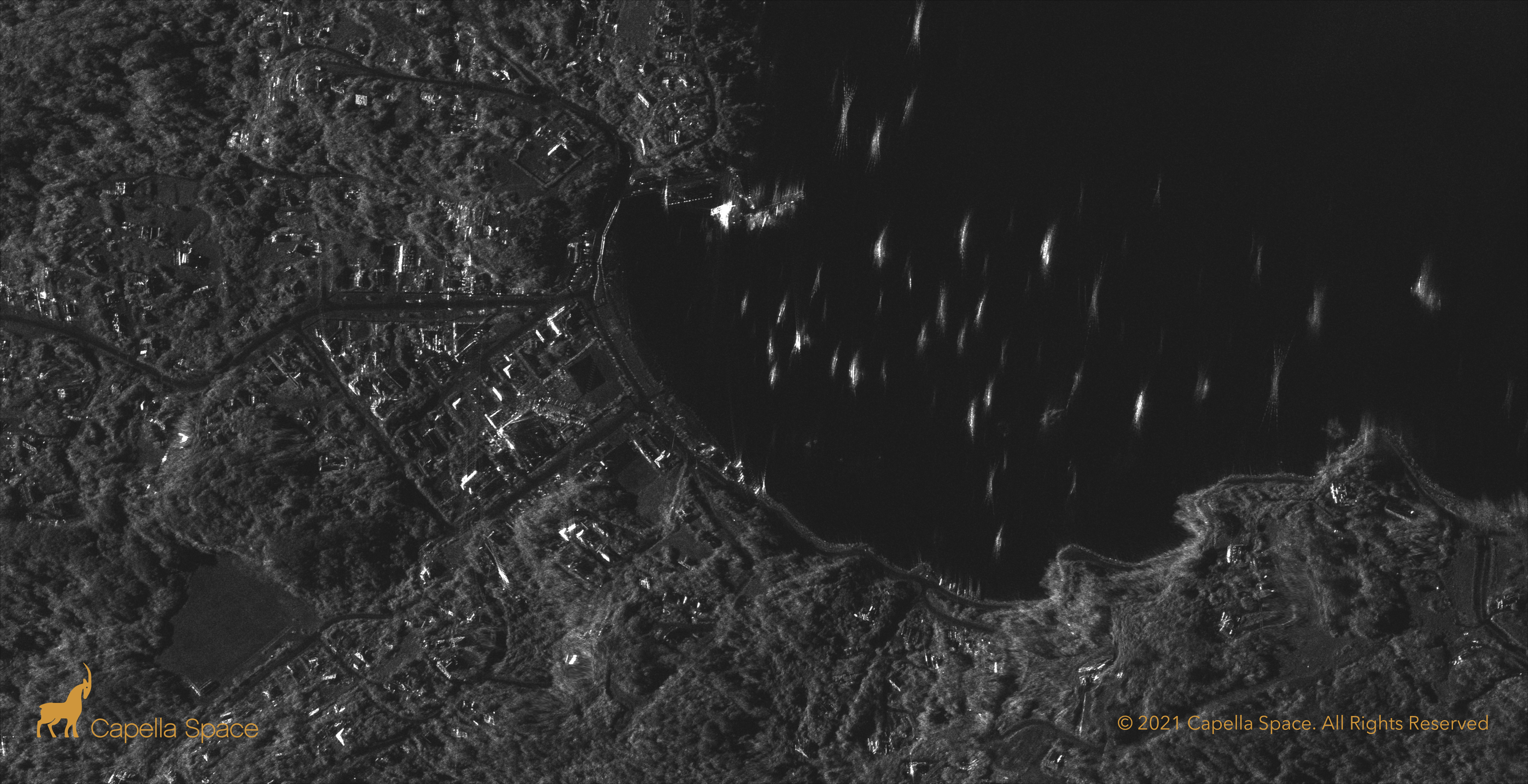 Image: Oban, Stewart Island, New Zealand, 6 June 2021, 10:08 am NZT
Contact us
Capella’s self-service offering will be of great use to many New Zealand sectors, including maritime and land search and rescue; oil spill response; earthquake, flood and landslide monitoring; and traffic volume assessments, to name a few.
If you’d like to find out about how SAR could benefit your intelligence activities, let’s chat.

.png "GL_A GenLess Organisation_WHITE (2)")