


by Steve Critchlow, Group Managing Director, on 18-Dec-2023 10:22:21
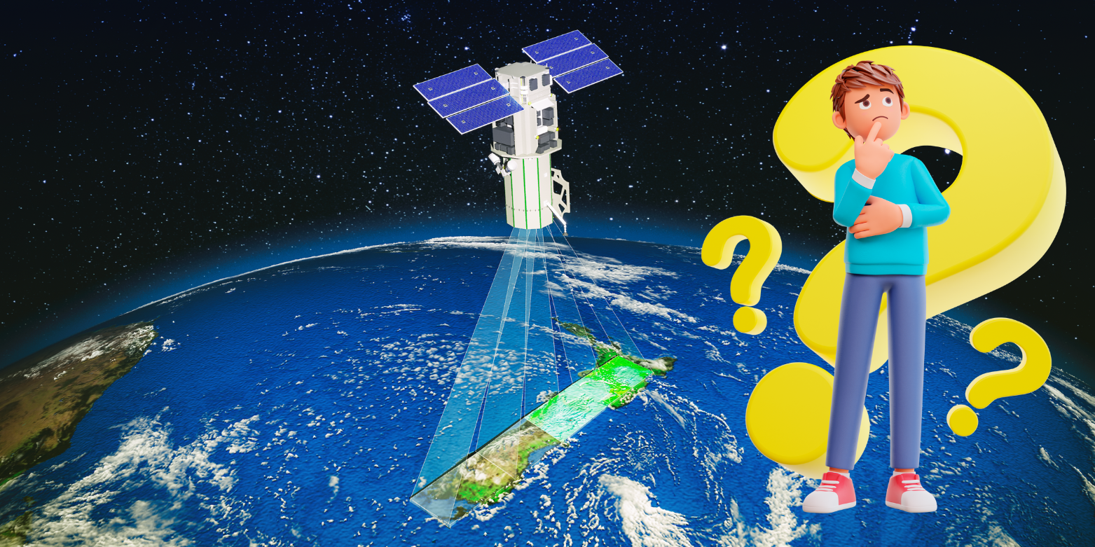
How much does satellite imagery cost?
It’s the question I get asked most often by organisations from all sectors exploring satellite imagery as the solution to their needs.
So, as the traditional summer flying season gets into gear (with all the hassle and limitations around suitable aeroplane flying days, availability, cost and environmental impact) I thought it would be timely to post a simple, transparent and straight-up blog on satellite imagery costs.
Now, most organisations that have done some initial research on the topic know that satellite imagery will help improve productivity and efficiency (compared with aerial imagery and site visits) as well as help them meet their carbon reduction goals.
In addition, they will probably have a pretty clear sense that it is LIKELY to be more cost effective too, but need the detail on that to build an ironclad business case.
So, here’s the pricing formulae that’s applied for archive imagery or when tasking a dedicated satellite to capture your area(s) of interest.
The satellite imagery pricing formulae
- Archive = Area* x Rate x Licence x USD-NZD x Age
- Tasking = Area* x Rate x Licence x USD-NZD x Urgency x Cloud%
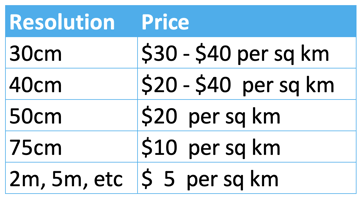
Optical ARCHIVE price ranges (NZ$)
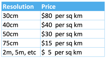
Optical TASKING price (NZ$)
An example costing for a standard purchase
Let’s say you wanted to task a satellite to capture one 500 sq km area at 50cm resolution, then that’s going to cost approximately NZ$15,000 + GST for the capture, plus a multiplier if a sharing licence (this depends on the satellite used) is required. The urgency multiplier can be 1.3x - 1.5x. But it pays to enquire as there are many options.
You can then expect delivery of your ready-to-use imagery between 2-4 days after capture.
And here’s the fine print and caveats on the above pricing…
*Service fee for Area of Interest < 1,000 sq km = $250 (+ $50 per AOI)
*Minimum area for archive is normally 25 sq km. Special case 4 sq km
*Minimum area for tasking is normally 100 sq km. Special case 50 sq km
*Price is for ‘view ready’ imagery and includes approximate orthorectification processing
*Prices are approximate as at December 2023
Mature technology and high-resolution imagery, combined with local Kiwi expertise and service
Switching from aerial imagery to using satellite imagery will naturally create questions and probably a bit of uncertainty early on – that’s only natural when changing the way things have been done previously.
However, if you or your business have been considering taking the next step in your imagery maturity journey, but were held back by a lack of clarity on the costs involved, then I hope the above gives you the pricing information needed.
And, if you still have questions then we are always here to help, as your local Kiwi experts on all things related to satellite imagery and derived data.

.png "GL_A GenLess Organisation_WHITE (2)")